

Xtracars®® Blog
Trips and Adventures
Costa Vicentina Route: a guide to exploring the Rota Vicentina by car
The Costa Vicentina is one of Portugal’s most spectacular natural destinations and one of the best coastal regions to explore by car. Stretching across the Alentejo and Algarve regions, this protected coastline forms part of the Southwest Alentejo and Vicentine Coast Natural Park, an area known for its dramatic cliffs, untouched beaches and traditional fishing villages.
It is also home to the famous Costa Vicentina Route, a network of long-distance walking trails often mentioned among Europe’s most scenic coastal hiking routes. Frequently featured in international rankings of Europe’s top coastal trails, the route attracts walkers, surfers and nature lovers from around the world.
What is the Costa Vicentina Route?
The Costa Vicentina Route is divided into two main paths: the Fishermen’s Trail and the Historical Way. The Fishermen’s Trail follows the coastline for around 226.5 kilometres, while the Historical Way runs inland for approximately 263 kilometres.
Many travellers choose to complete only selected stages, combining hiking days with beach visits, surfing or time spent exploring the small coastal towns along the route.
Fishermen’s Trail: the most scenic route on the Costa Vicentina
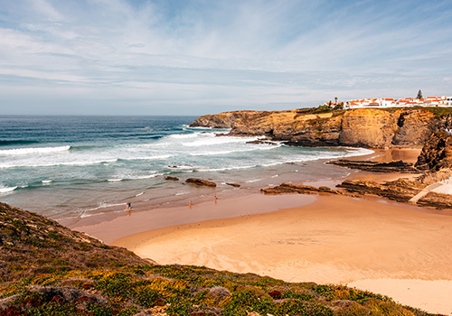
The Fishermen’s Trail is the most famous section of the Costa Vicentina Route. The route follows rugged cliffs overlooking the Atlantic, undeveloped beaches and sandy coastal paths with uninterrupted sea views.
Stages from Porto Covo to Vila Nova de Milfontes, Almograve to Zambujeira do Mar and Arrifana to Carrapateira are among the most popular with first-time visitors to the Costa Vicentina.
Although highly scenic, this trail can also be physically demanding due to deep sand, strong coastal winds and constant sun exposure. For that reason, many travellers prefer to hike only certain sections and use a car to return to their accommodation or explore nearby beaches and villages.

Historical Way: a quieter side of the region
The Historical Way offers a calmer and less demanding alternative. Instead of following the coastline, the trail runs from Santiago do Cacém towards the southwest and passes through rural villages, farmland and quiet countryside landscapes.
It is ideal for travellers who want long walks away from the most exposed coastal cliffs, while still experiencing the authentic atmosphere of the Alentejo and Algarve regions. Many hikers combine both routes to alternate between coastal scenery and more peaceful inland stages.
What to Pack
- Comfortable hiking clothes suitable for the season.
- Well-worn hiking shoes or boots with good grip (avoid flip-flops or casual sandals).
- A lightweight daypack.
- At least 1.5–2 litres of water per person.
- Energy snacks such as fruit, sandwiches, nuts or energy bars.
- Hat or cap and high-SPF sunscreen.
- Waterproof jacket and a spare change of clothes if rain is forecast.
- Walking poles (recommended for sandy sections and to reduce strain on the knees).
- Swimsuit and a small towel if hiking between late spring and early autumn.
- Fully charged mobile phone, offline maps or GPS, and a power bank.
- Small first-aid kit with plasters, bandages and disinfectant.
- Camera, binoculars and some cash for small cafés or local shops.
Practical Tips
- Hike between September and June to avoid the intense summer heat.
- Start your walk early, especially on warmer days, as there is very little shade along the trail.
- Stay on the marked paths to protect the fragile dune ecosystem and for your own safety.
- Keep a safe distance from cliff edges, as coastal erosion makes them unstable.
- The trail is not recommended for people with vertigo or a fear of heights.
- Carry enough water and food, as not every stage passes through villages with cafés or grocery stores.
- Book accommodation in advance, particularly during spring and autumn.
- Wild camping is prohibited throughout the natural park.
- Download GPS tracks before setting off, as mobile coverage can be limited in some areas.
- The Fishermen's Trail is for hikers only and is not suitable for bicycles due to its narrow, sandy paths.
When is the best time to visit the Costa Vicentina?
Spring and autumn are generally the best seasons for hiking the Rota Vicentina, thanks to milder temperatures, fewer crowds and more comfortable walking conditions. Summer remains popular for beach holidays and surfing, although the heat can make some stages more challenging.
Winter offers a quieter experience with fewer visitors, but rain, wind and rougher trail conditions can make exposed cliff-top sections more challenging.
Why is a car useful on the Costa Vicentina?
For international visitors, transport is one of the most important things to consider when planning a trip to the Costa Vicentina. The region is relatively remote, with no direct railway line along much of the coastline and limited public transport connections between many villages and trailheads.
Having a car is often essential not only for reaching the starting points of different hiking stages, but also for exploring the wider region on rest days. It allows travellers to move more freely between beaches, accommodation, restaurants and smaller villages that are difficult to access without private transport.
A car also makes it easier to plan a flexible itinerary, combining different sections of the Rota Vicentina without relying entirely on public transport schedules.
Exploring the Costa Vicentina by car with more freedom
A trip to the Costa Vicentina is about far more than hiking alone. Between wild beaches, fresh seafood, surfing spots and dramatic Atlantic viewpoints, the region rewards slow and flexible travel.
With an Xtracars car subscription, visitors can enjoy a modern and comfortable vehicle to explore different sections of the Rota Vicentina with greater freedom, making it easier to discover one of Europe’s most impressive coastal regions at their own pace.